Few visitors to Mussoorie go beyond the Mall or beyond the roads. There are virtually no signs to guide the way to most of the tracks outlined in the book. Those of you who visit Mussoorie for only days or weeks have no time to waste on dead-ends, and so this book provides the necessary information to reach these remote places. All the maps in this book were produced using a global positioning system device, so they are all to scale, and all of the walks can be completed within a day.
The book gives directions on where you can access the tracks to download the gpx format. Mussoorie runs from west (the library end) to east (the Picture Palace end) along an escarpment. Walks from Mussoorie past the library end take you to Happy Valley (Walk 12), Kempty Falls (Walk 15), the ruins of Mackinnon's Brewery (Walk 20), George Everest's House (Walk 31), and Benog (Walk 28). Walks past the Picture Palace end take you to Lal Tibba (Walk 13), Top Tibba (Walks 1), the valley to the north of Masrana (Walk 9), and Surkanda Devi (Walk 6).
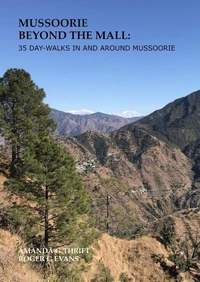
All of these walks take you through forests and streams, and past small villages. On a clear day you can see panoramic views of the Garhwal ranges of the Himalayas from vantage points along many of the walks. The maps in this book were constructed by the authors using a global positioning system device. There will be slight errors with the tracks as the accuracy is only as good as the access to satellites.
This means that in some places, particularly in the valleys, errors can be up to about 30 m (both on the ground and in altitude). Be aware that the kilometres for the walks are based on the surface of the earth, so do not account for climbs and descents. Consequently, we have also listed the ascent and descents for each walk, to give a better indication of the hike. In addition, the maps are far from complete.
At the front of the book you will find a master map that covers all of the 35 walks. For each walk, we then provide a section of the master map pertaining to the specific walk, along with the route for the walk itself. For each walk, we then provide some general information followed by a graph showing the altitude, and numbered steps to guide you along each section of the walk. The steps are numbered on the maps and the graphs so you can (we hope) easily find your way from one section to another.
This new edition has arisen because of a number of requests from readers and the ever-changing landscape around Mussoorie. First, we have had a number of requests from readers to have more shorter walks. So, this version now has more walks, many of which are less than 4 hours. Second, with each village now having road access, some of the original paths became roads, while the detritus from some of the roadwork caused landslides onto other paths below.
Many of these paths below are now unsafe. Because it is not that interesting to walk along the roads, with the roads being longer and more gradual than the original paths, we have tried to find alternative ways so that time spent on these roads is minimised. Third, some of the paths are little-used, so the forest now encroaches on them so that they are impassable. We have modified some of the walks so that these overgrown paths are omitted from the book.
Finally, some of the properties in Mussoorie used to allow common thoroughfare. Many of the new owners of these private properties have fenced them off, so that they are no longer accessible. In finalising this book in late 2024, we have walked every single path, checked all instructions, and redrawn all maps and graphs. However, Mussoorie is ever-changing, so some paths will change in the future.
When we know about these, we will provide updated instructions on the website indicated in the book. We hope you enjoy discovering the spectacular natural beauty of Mussoorie as much as we have.
Few visitors to Mussoorie go beyond the Mall or beyond the roads. There are virtually no signs to guide the way to most of the tracks outlined in the book. Those of you who visit Mussoorie for only days or weeks have no time to waste on dead-ends, and so this book provides the necessary information to reach these remote places. All the maps in this book were produced using a global positioning system device, so they are all to scale, and all of the walks can be completed within a day.
The book gives directions on where you can access the tracks to download the gpx format. Mussoorie runs from west (the library end) to east (the Picture Palace end) along an escarpment. Walks from Mussoorie past the library end take you to Happy Valley (Walk 12), Kempty Falls (Walk 15), the ruins of Mackinnon's Brewery (Walk 20), George Everest's House (Walk 31), and Benog (Walk 28). Walks past the Picture Palace end take you to Lal Tibba (Walk 13), Top Tibba (Walks 1), the valley to the north of Masrana (Walk 9), and Surkanda Devi (Walk 6).
All of these walks take you through forests and streams, and past small villages. On a clear day you can see panoramic views of the Garhwal ranges of the Himalayas from vantage points along many of the walks. The maps in this book were constructed by the authors using a global positioning system device. There will be slight errors with the tracks as the accuracy is only as good as the access to satellites.
This means that in some places, particularly in the valleys, errors can be up to about 30 m (both on the ground and in altitude). Be aware that the kilometres for the walks are based on the surface of the earth, so do not account for climbs and descents. Consequently, we have also listed the ascent and descents for each walk, to give a better indication of the hike. In addition, the maps are far from complete.
At the front of the book you will find a master map that covers all of the 35 walks. For each walk, we then provide a section of the master map pertaining to the specific walk, along with the route for the walk itself. For each walk, we then provide some general information followed by a graph showing the altitude, and numbered steps to guide you along each section of the walk. The steps are numbered on the maps and the graphs so you can (we hope) easily find your way from one section to another.
This new edition has arisen because of a number of requests from readers and the ever-changing landscape around Mussoorie. First, we have had a number of requests from readers to have more shorter walks. So, this version now has more walks, many of which are less than 4 hours. Second, with each village now having road access, some of the original paths became roads, while the detritus from some of the roadwork caused landslides onto other paths below.
Many of these paths below are now unsafe. Because it is not that interesting to walk along the roads, with the roads being longer and more gradual than the original paths, we have tried to find alternative ways so that time spent on these roads is minimised. Third, some of the paths are little-used, so the forest now encroaches on them so that they are impassable. We have modified some of the walks so that these overgrown paths are omitted from the book.
Finally, some of the properties in Mussoorie used to allow common thoroughfare. Many of the new owners of these private properties have fenced them off, so that they are no longer accessible. In finalising this book in late 2024, we have walked every single path, checked all instructions, and redrawn all maps and graphs. However, Mussoorie is ever-changing, so some paths will change in the future.
When we know about these, we will provide updated instructions on the website indicated in the book. We hope you enjoy discovering the spectacular natural beauty of Mussoorie as much as we have.